What is there to see in Williams, Arizona? Lakes, historic structures, a drive-through park… Oh, and Sycamore Falls, which you do need to hike to.
Last updated: April 7, 2025
How to Visit Sycamore Falls, Arizona: Driving, Hiking, and Things to Do Nearby
Williams, a small town in Northern Arizona, entices with its historic heritage and rustic vibe. Neither of these intrigued me at first, though. We had seen some of the most incredible landscapes in Utah, Arizona, Nevada, and California by the time we arrived here. So the bar was raised too high already.
Williams… Let’s just say, I didn’t expect the place with its small town charm to come even close to it. Yet the city superseded all my expectations. To be precise, not Williams itself, but Sycamore Falls, a natural landmark that was said to be one of the most scenic places to visit nearby.
Visit Sycamore Canyon and Sycamore Falls
Nestled within 21-mile-long Sycamore Canyon, Sycamore Falls hardly ever makes it on the list of the popular destinations to visit in Arizona. The natural wonder entertains mostly locals and those adventure seekers that long for the hidden gems and untrodden paths.
While Sycamore Falls often surprises some oblivious hikers that come across the site, Sycamore Canyon is what inspires them in the first place. The scenic canyon begins in a ponderosa pine forest on the outskirts of Williams and stretches through three national forests all the way to the Verde Valley. Home to diverse species of plants and animals, the area is a part of the Sycamore Canyon Wilderness.
Locals, however, stick to a more appealing name when referring to the Sycamore Canyon region near Williams. Paradise Forks or the Forks is how the area is known here. It doesn’t sound surprising after you visit this part of the canyon and feast your eyes on Sycamore Falls.
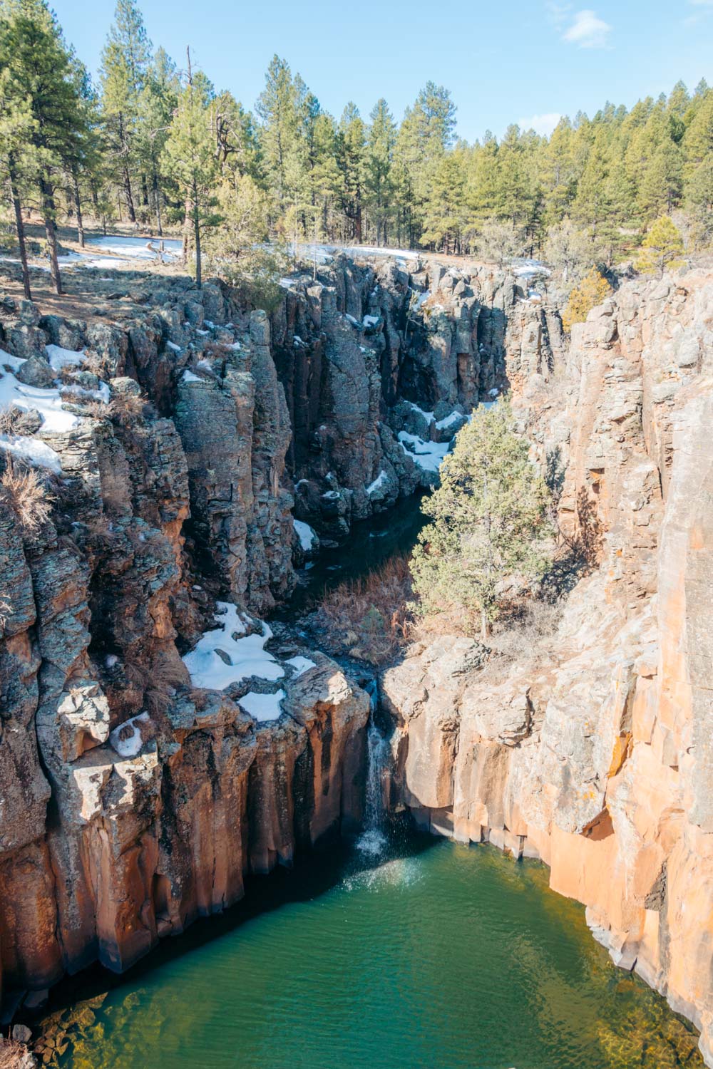
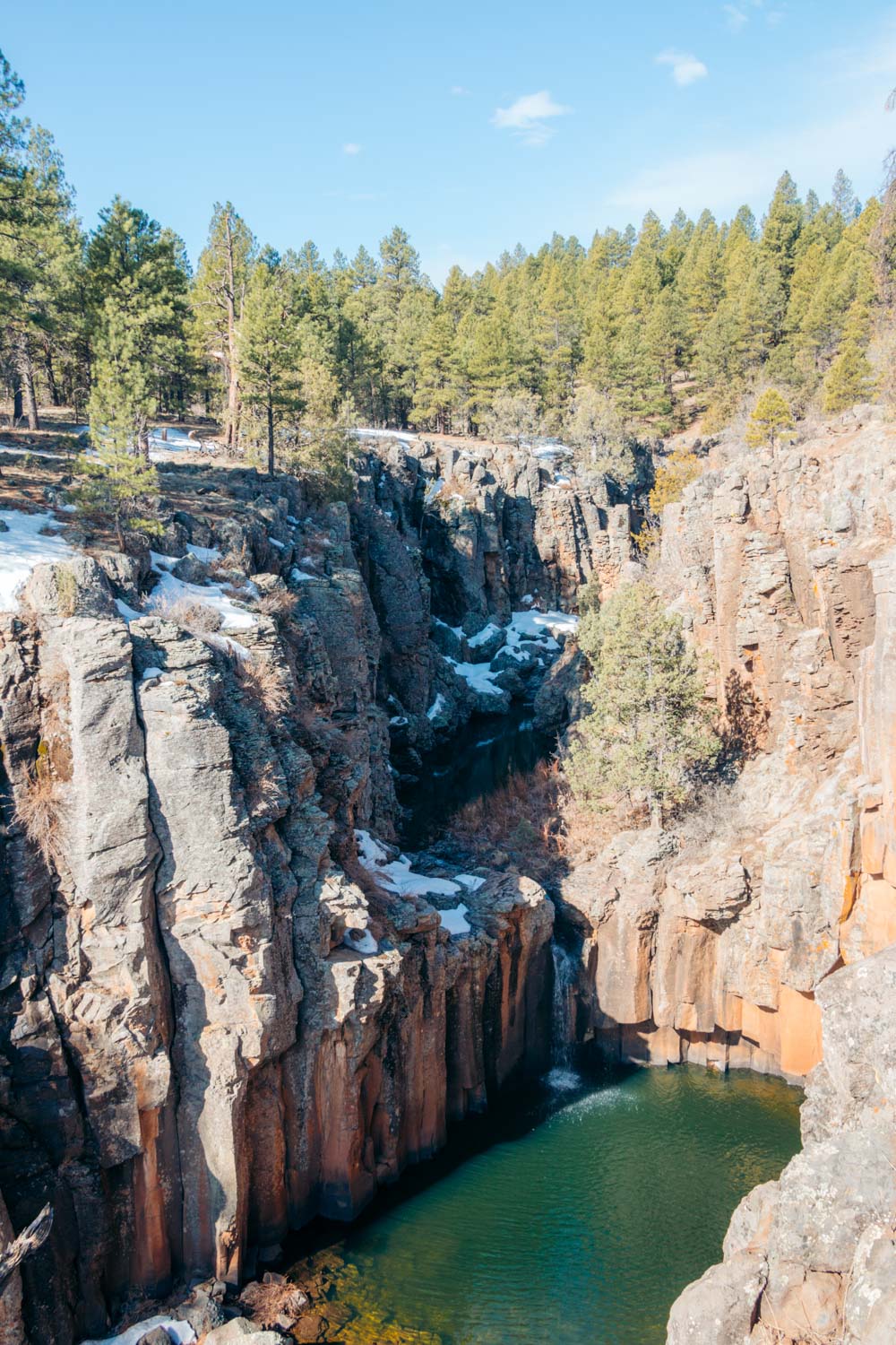
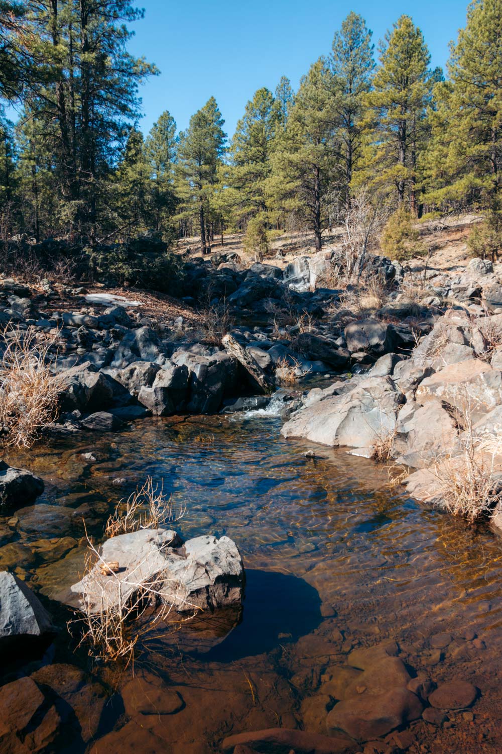
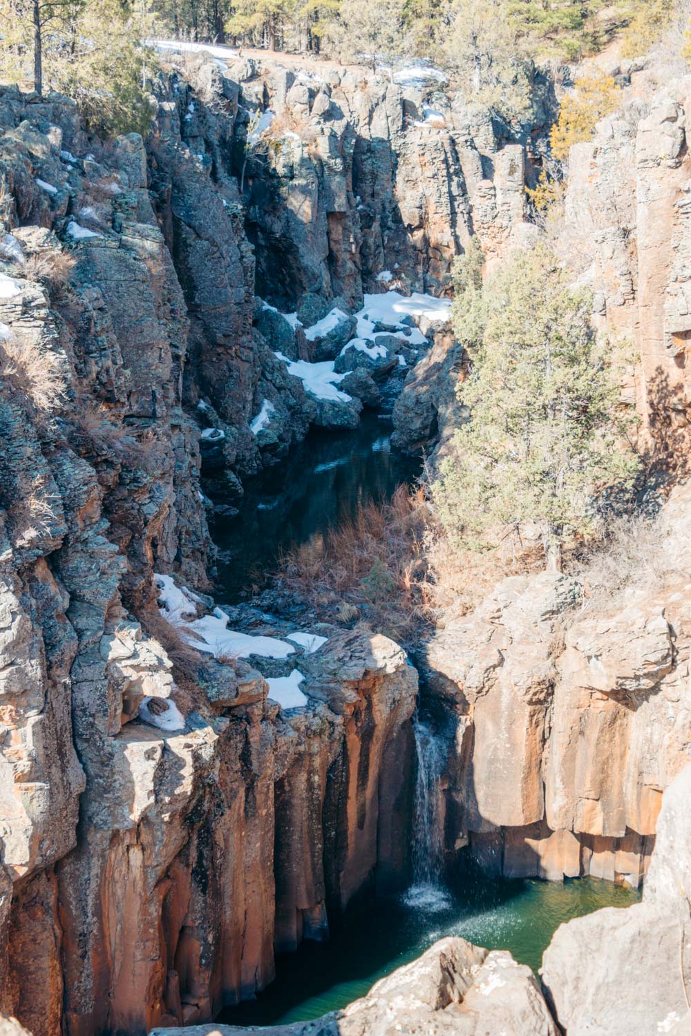
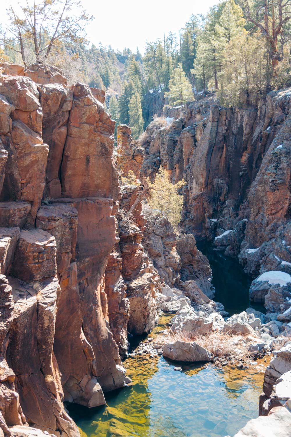
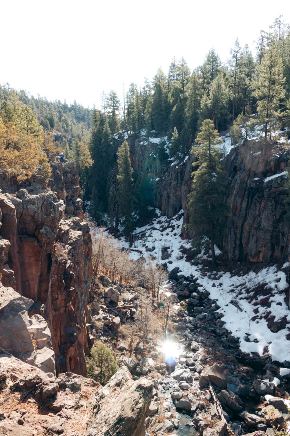
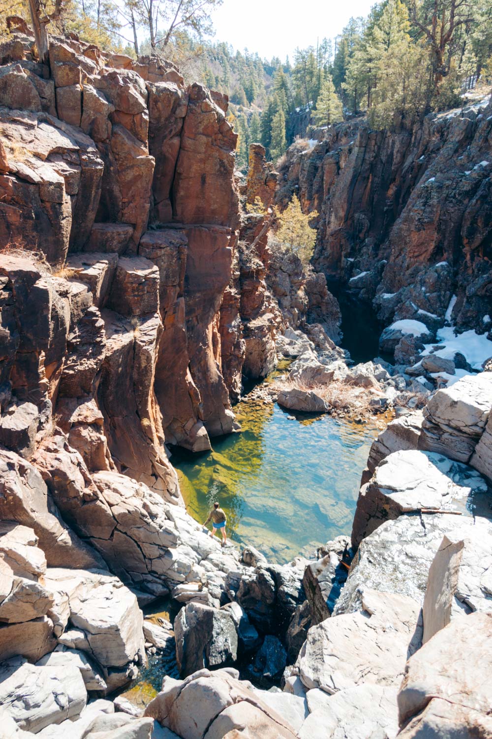
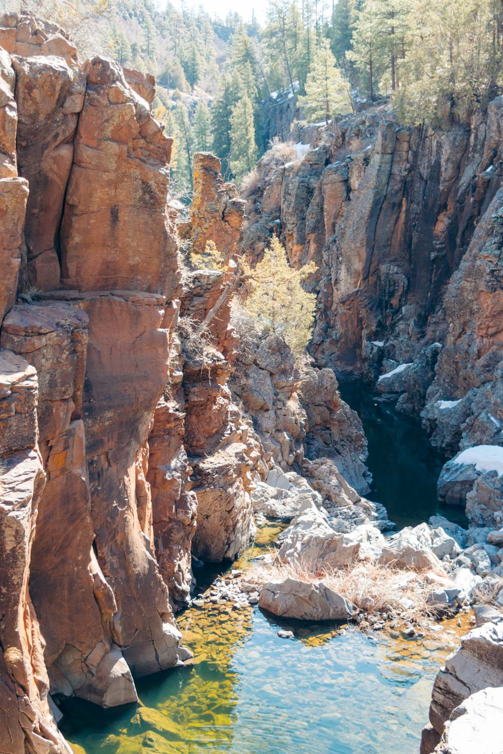
Here the long canyon with towering cliffs comes to a fork. The head of each of its branches houses two seasonal waterfalls, known as Sycamore Falls, the highlights of this secluded wilderness.
Location
To visit Sycamore Falls, venture into the Kaibab National Forest in Northern Arizona. The natural attraction sits about 15 miles from historic Williams along a dirt forest road, at the upper head of the canyon at Paradise Fork.
For the majority of long-distance hikers, a visit to the Sycamore Canyon Wilderness is almost never about the falls, but the 11-mile Sycamore Rim Trail. Hiking along the cliff edge above the gorge formed by Sycamore Creek, they inevitably come across the two seasonal waterfalls.
HOW TO VISIT SYCAMORE FALLS
Hiking 11 miles, however, is not a piece of cake. Only a few can conquer this distance on foot and enjoy many of Arizona’s landmarks along the way. The easiest way to visit Sycamore Falls, though, is by driving first and then walking downhill to the basalt walls with the waterfalls hidden at the heads of the Fork.
How to Get to Sycamore Falls by Car
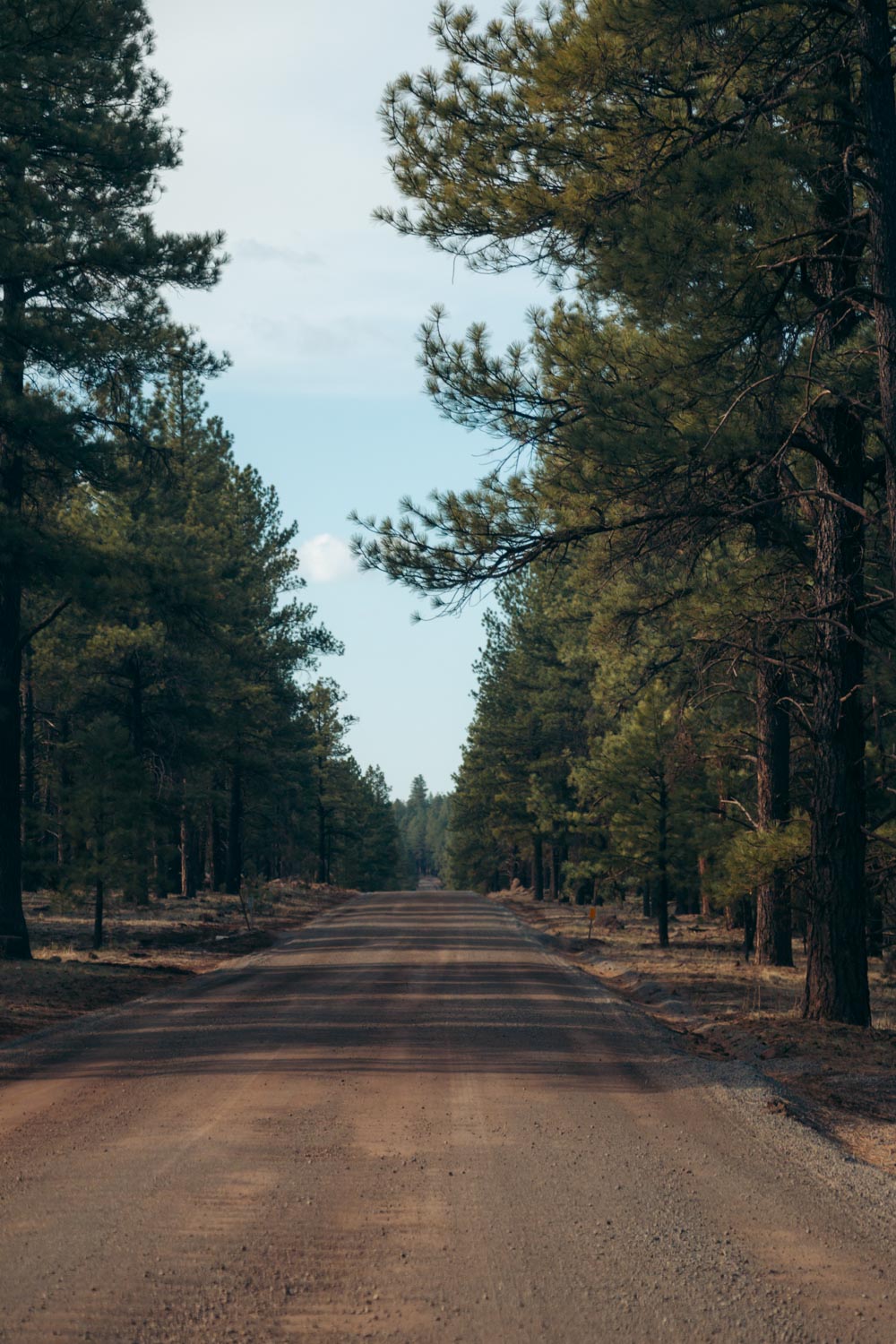
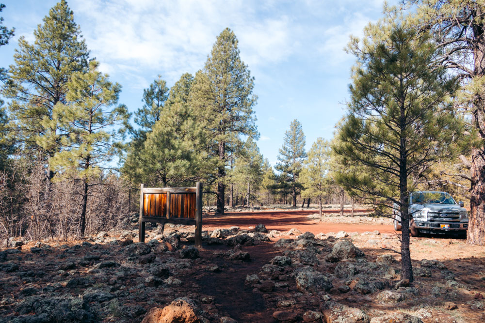
If you visit Sycamore Falls while driving from Williams, take W Historic Route 66 and stay on it for 4 miles. Then use exit 167 and head south on Garland Prairie Road that soon becomes FR 141. Follow this forest service road for roughly 9 miles. At an intersection, turn right to stay on White Horse Lake Road/FR 109. Continue on for another 3 miles until you reach a small parking lot with restrooms and a Sycamore Rim Trail sign.
It takes approximately 30-40 minutes to reach the Sycamore Falls area by car. Be sure to slow down and take as much time as you need while driving along the forest road before finishing this part of your trip to Sycamore Falls.
Visit Sycamore Falls: Map
Hike to Sycamore Falls
Sycamore Falls Hike: Quick Trail Facts
- Length: 0.5-mile loop trail
- Elevation Gain: 104 feet
- Trailhead: Sycamore Rim Trailhead
- Difficulty: Easy
- Time: 15-20 minutes
Sycamore Falls Hike: Trail Description
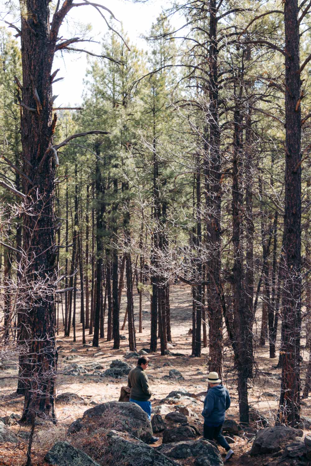
Normally, you don’t have any difficulty finding an empty spot to park at the trailhead. We visited Sycamore Falls on a Saturday afternoon, and there was only one person lingering nearby. He left pretty soon, leaving the entire area to us to explore.
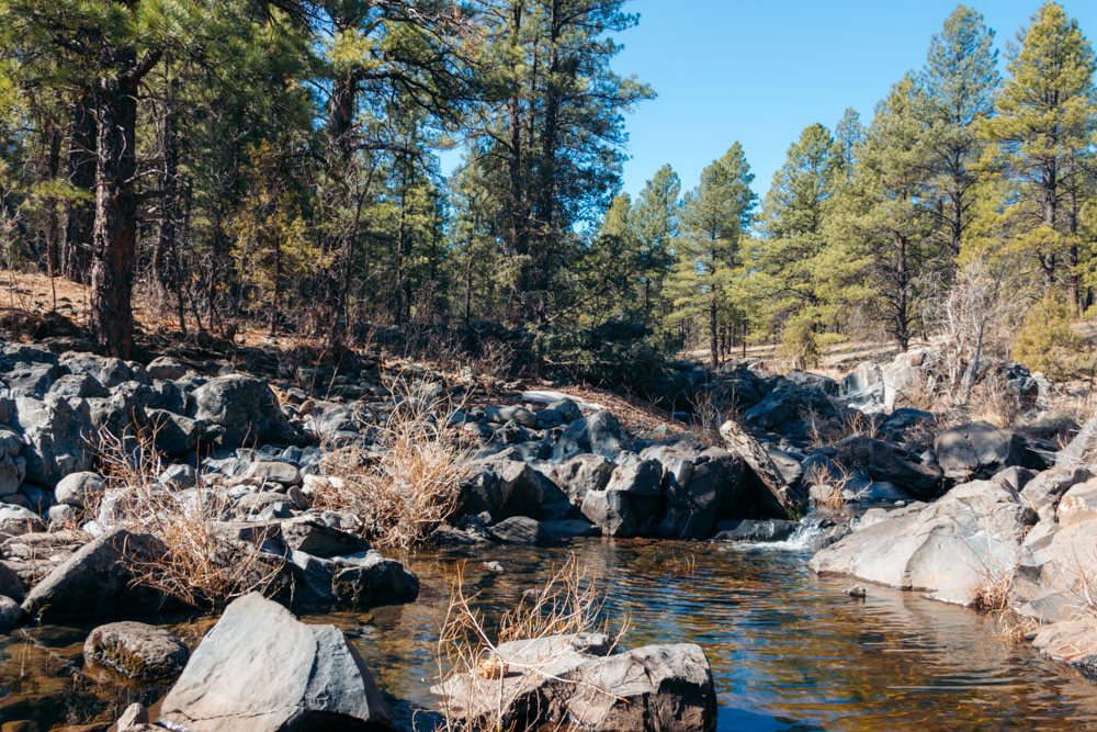
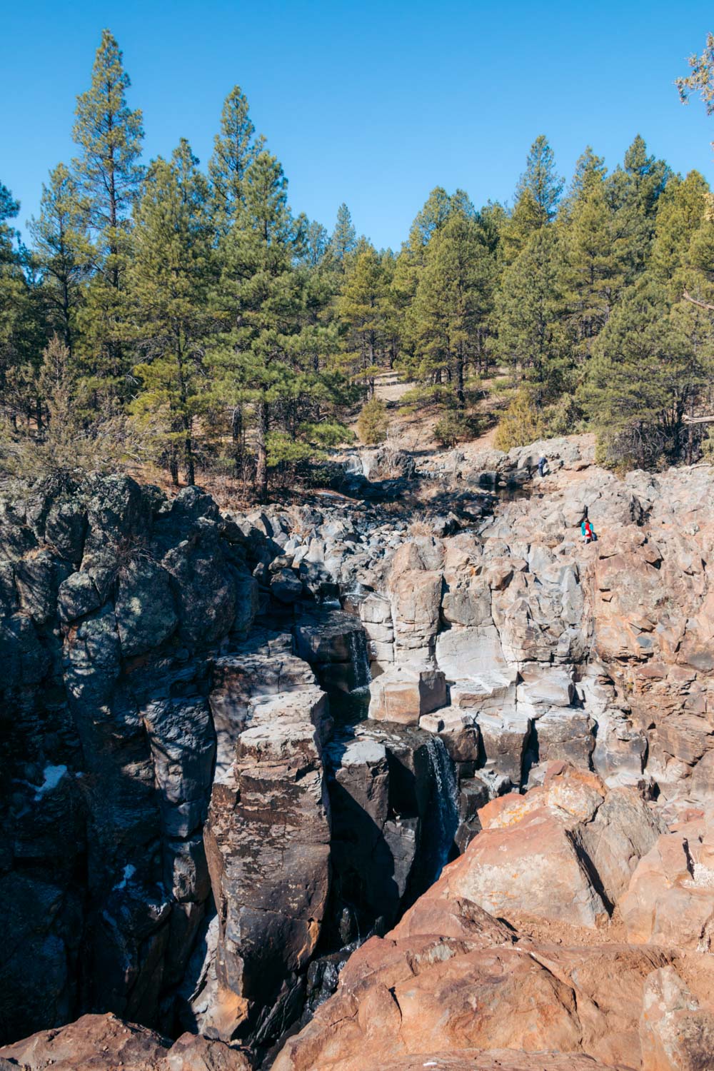
A well-trodden path, partially aligned with rocky and wooden stairs is only 0.25 mile long. You would follow it until you reach the cliff edge with the panoramic views of the waterfall. If you visit Sycamore Falls in fall or winter, the trail may be muddy and difficult to hike along. Make your own “route” down the gradually descending hill, staying as close as possible to the official trail.
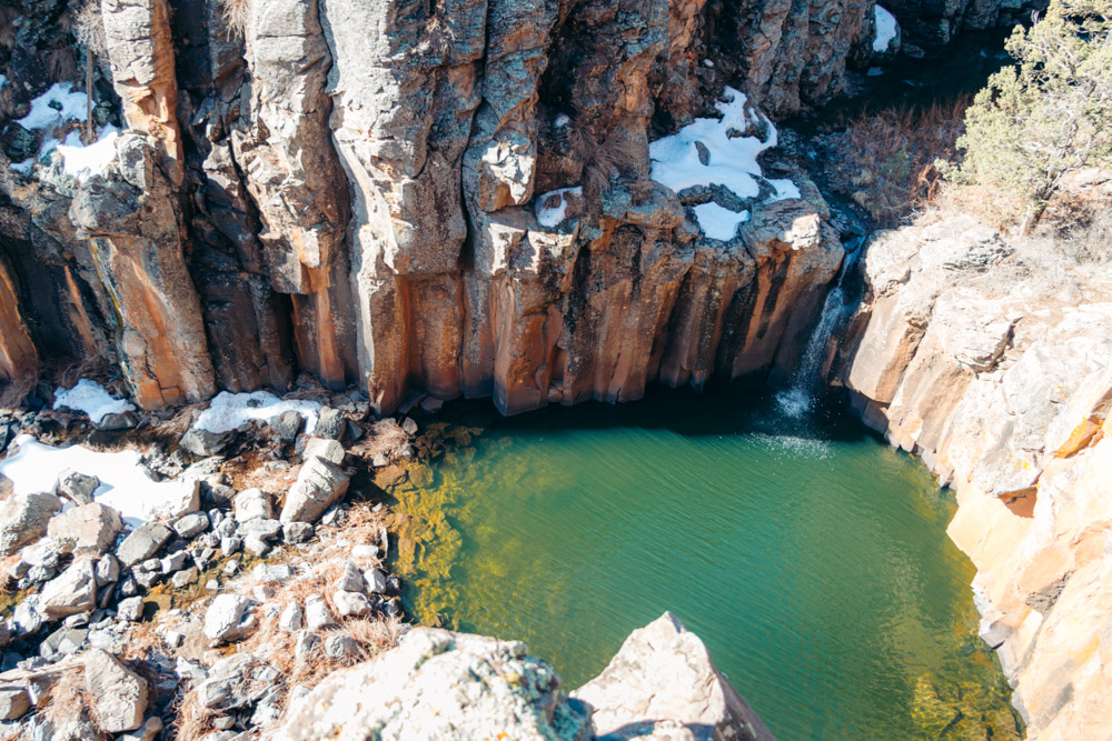
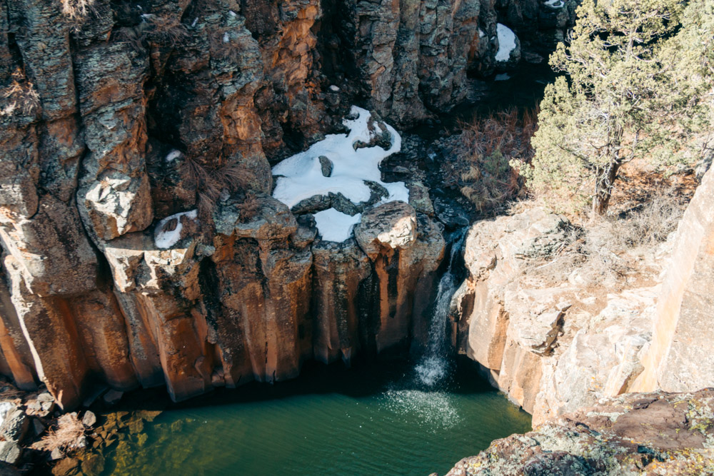
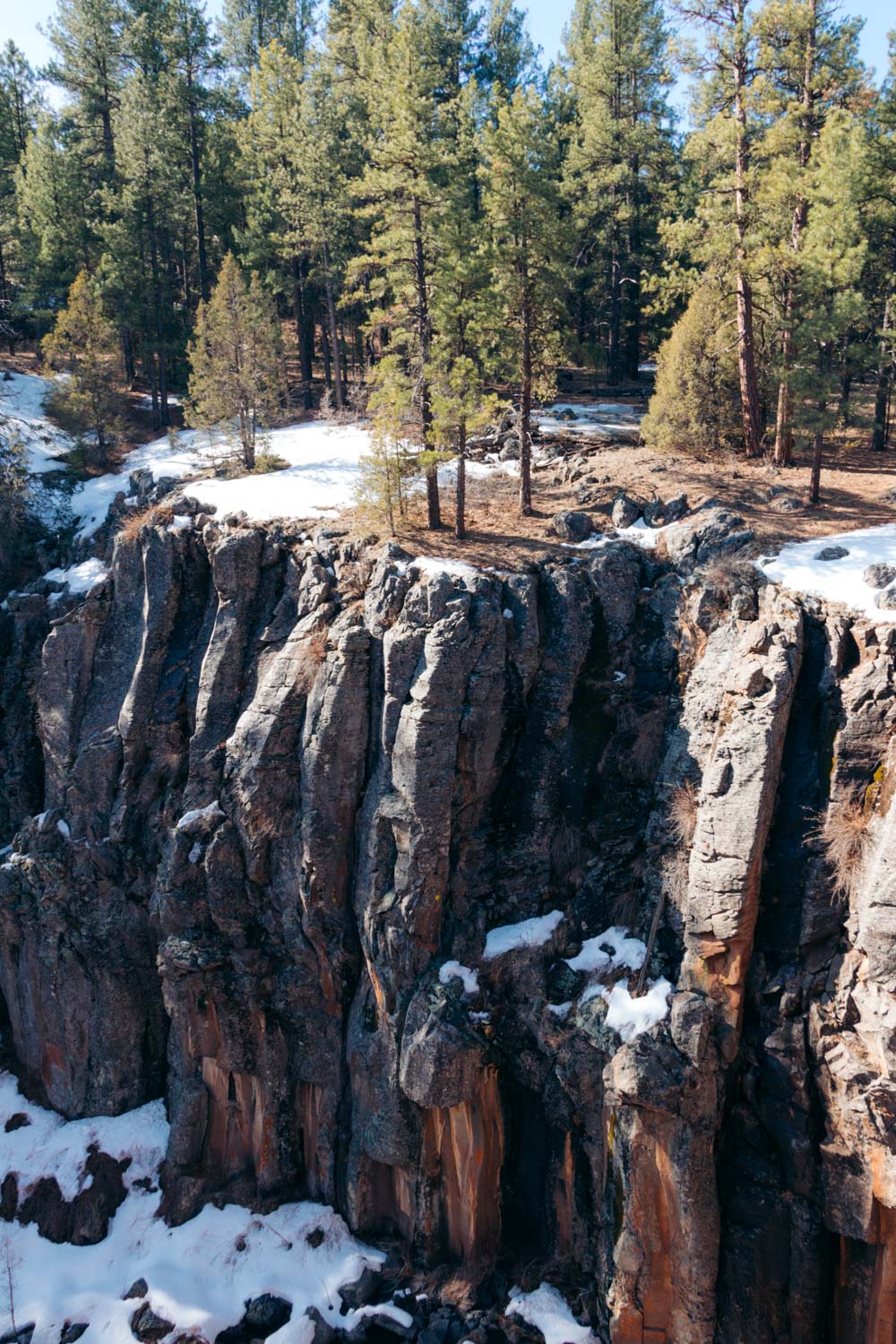
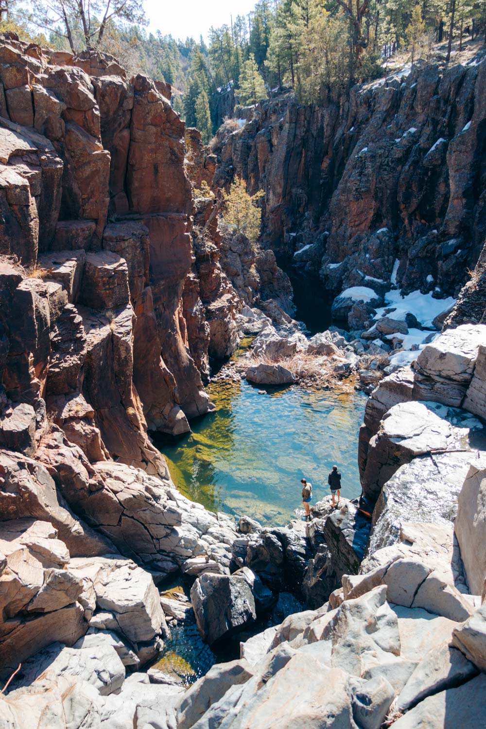
As you reach the cliff, the trail splits. Each fork leads to a separate waterfall. If you have enough time, be sure to visit both members of the Sycamore Falls family. Otherwise, tread to the right fork, which houses the most imposing waterfall.
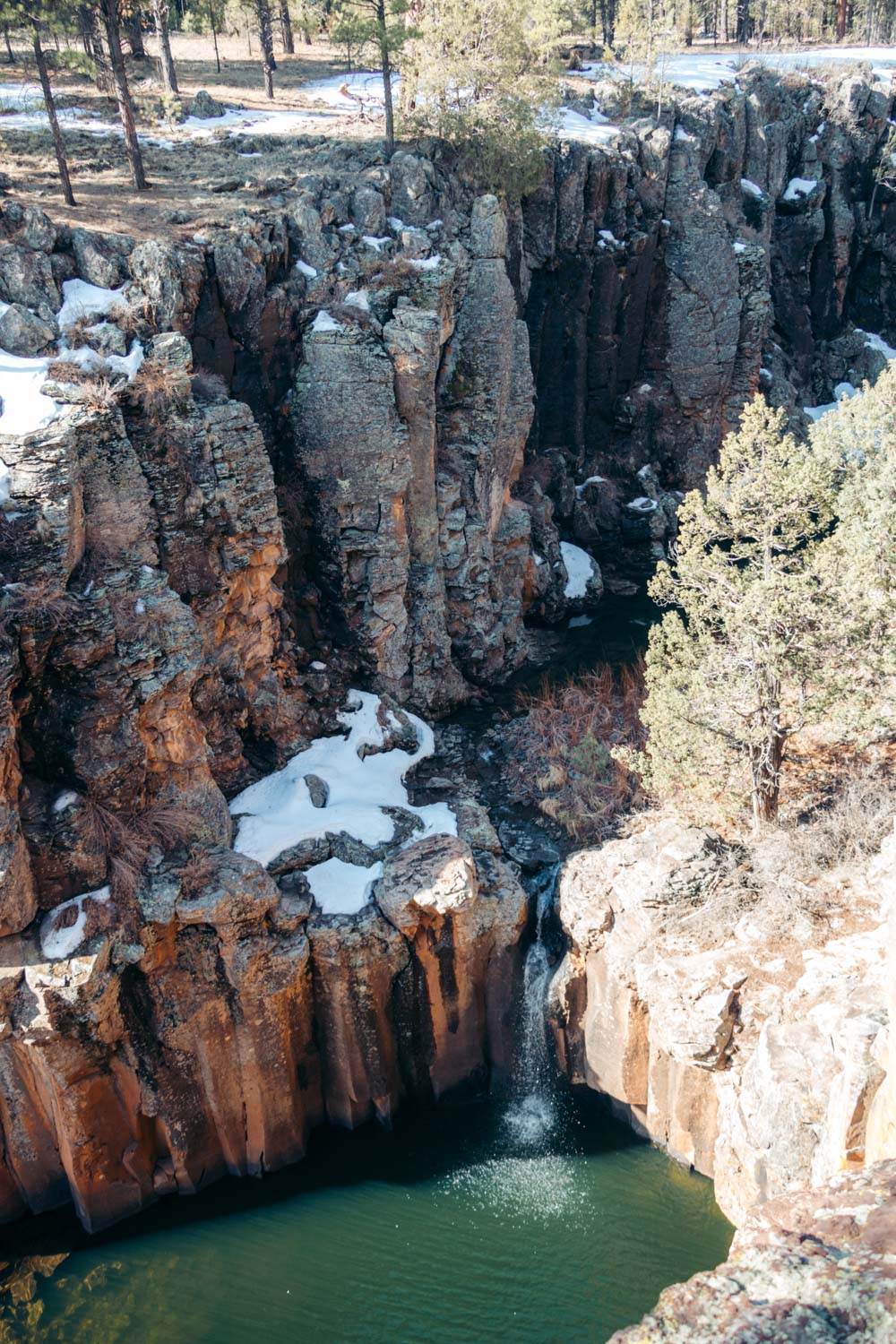
Depending on the time you visit Sycamore Falls, the site may look like a roaring giant or a hardly visible trickle. But a natural pool created by the colossal basalt cliffs undoubtedly indicates the presence of the waterfall. The water trapped at the bottom acquires emerald shade, a signature mark of Sycamore Falls.
To visit the second waterfall of the Sycamore Falls group, hike to the opposite side of the canyon. The 70-foot falls doesn’t make you neither walk nor wait long.
The Best Time to Visit Sycamore Falls
Sycamore Falls is a seasonal attraction. The flow is the most powerful during the spring run-off or monsoon season, between July and September.
We visited Sycamore Falls at the beginning of April, and it already looked like a trickle. On the other hand, the trail was dry and easy to walk along. The cliff walls also didn’t show any sign of the recent run-off.
Visit Sycamore Falls in late fall or winter, and all you find is a tiny dribble running down the cobalt cliff to the emerald pool below.
Tips for Visiting Sycamore Falls
No Four-Wheel Drive is Required
If you visit Sycamore Falls during the dry season, you can easily navigate through the dirt forest road in a standard passenger car. Yet be sure to slow down and drive carefully.
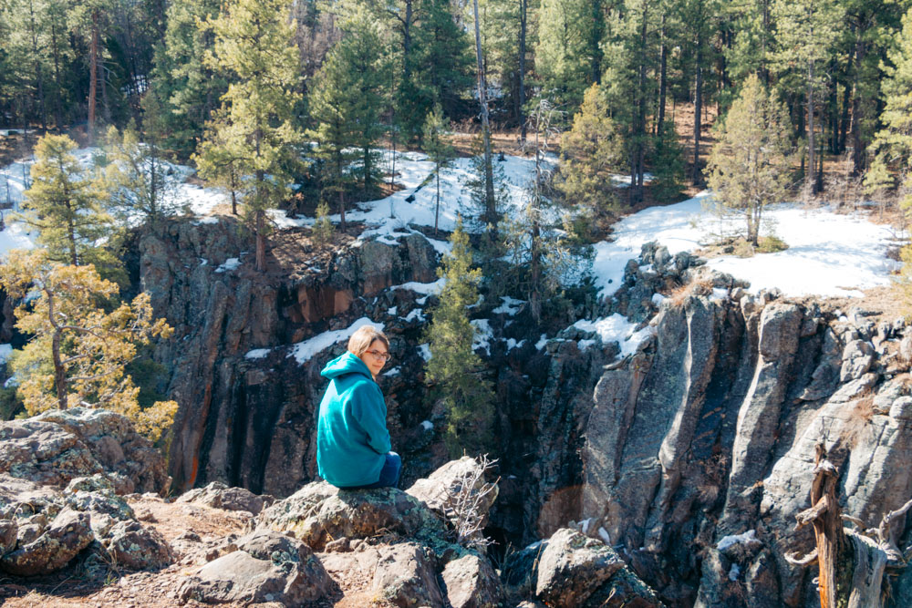
Explore the Rim
Once you get to the cliff edge, explore a little bit to find the best vantage point. Scattered on top of the massive rock walls, each and every overlook presents different sights of the waterfall.
Be Aware of Steep Drop-offs
Play it safely while visiting Sycamore Falls. The high basalt walls have steep drop-offs. Don’t get too close to the edge, especially when the rocks are wet.
Wear Appropriate Shoes
Whether you drive or hike all the way to Sycamore Falls, make sure to wear comfortable hiking shoes. The trail may be slippery. Furthermore, you shouldn’t get on the rocks surrounding the waterfall if your shoes aren’t slip-resistant.
Download Offline Map
Arizona’s wilderness offers the partial or full absence of cell service. Don’t take chances, grab a hard copy map of the area. Alternatively, download the offline map before venturing into the forest to visit Sycamore Falls.
Keep a Safe Distance from Wildlife
If after admiring Sycamore Falls you plan to hike deeper into the woods, make sure you know how to protect yourself from the animals in the wild. Black bears, mountain lions, and ringtail cats roam in the Sycamore Canyon area and can cause some disturbances to the oblivious hikers.
Admission
Sycamore Falls is free to visit, 7 days a week, 365 days a year.
Things to Do near Sycamore Falls
Rock Climbing
During the dry season and when the waterfall is not at its strongest, the basalt walls serve as an excellent place for advanced rock climbing. Highlining is another popular activity in the Sycamore Canyon area during this time.
Hiking
As we mentioned before, many outdoor enthusiasts visit Sycamore Falls while hiking along the 11-mile Sycamore Rim Trail. The path runs along the rim, swings by the Pomeroy Tanks area, ascends the peak of KA Hill, and comes across a few historic sites.
Alternately, you can hit the 8-mile, round-trip Parsons Trail or the strenuous, 2.9-mile Taylor Cabin Trail and explore different sites.
Exploring Landmarks of Williams
Nestled so close to Sycamore Fall, Williams is the best place to visit for a change of scenery. The charming town surprises its guests with the Pete’s Route 66 Gas Station Museum, historic Route 66, secluding lakes nearby, and one of a kind drive-through wildlife park, Bearizona.
Read More
- SLOT CANYON: How to Hike the Cathedral Wash Trail, Arizona
- LAKE HAVASU: One Day in Lake Havasu City, Arizona
- CLIFF DWELLING: How to Visit Montezuma Castle National Monument, Arizona
- NATURAL BRIDGE: Hiking the Devil’s Bridge Trail in Sedona, Arizona
- HIDDEN GEMS: Top 10 Hidden Gems and Best-Kept Secrets in Arizona

Thanks for this information – is early November also good to do this hike into the Falls? Williams is an eclectic little town with lots of old Route 66 history!
Author
It sure is, and I hope some fall colors have sneaked into the forest around the waterfall by now.